Showing posts with label Superior Hiking Trail. Show all posts

Saturday, October 5, 2013

Hiking to Two Harbors, Leg 6: Normanna Rd. to Sucker River

A welcome sign at the Normanna trailhead
I played hooky this week and got back on the Superior Hiking Trail. I wanted to make some progress on my big "summer" goal of hiking all the way to Two Harbors. Five day hikes in, I had made it to Normanna Road, on the northeast outskirts of Duluth.

After hiking on everything from city sidewalks to snowmobile trails, after hiking through everything from farmfields to graveyards, after hiking with everything from baby strollers to ATV's, I was thrilled to be on a real hiking trail. This section of the SHT is nine miles long. On this hike from Duluth to Two Harbors, this was the first pure and simple hike, just foot travel, no wide snowmobile trails or paved walkways.

Me in some maple woods
Just a few hundred yards in, I had to literally stop and tighten my boot laces. On a classic SHT layout, the trail winds up and over woodland ridges, over boulders, down steep streambanks, and more. For the first time in a long run of hiking trail, I actually had to hike.I loved it.

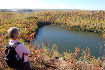
The SHT here is nearly all on state or county forest land. Some of the highlights along the trail section are beaver ponds and the open beaver meadows, a classic North Shore ridgeline maple forest, just starting to turn yellow and orange, and the scenic gurgles of the Sucker River.


Even the older logged areas, cut over two or three years ago, had some beautiful fall flowers.

Asters blooming in October in a logged area

Nine miles is a decently long hike, and I was starting to feel the wear in my joints toward the end. I had driven to the ending trailhead on Fox Farm Road and ridden my bike nearly ten miles along dirt and paved road to the starting trailhead, so I had already pushed my middle-aged body more than I would at a typical day at the office.

So just when I felt I was in my little hiking nirvana...

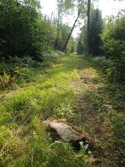
The SHT goes straight through that brush pile

A bit tired, a bit elated from actually hiking in actual woods, I was thrown off my game in the last mile, as the trail entered an active logging area. I'd heard the rumble of engines and the hum of saws for a good half hour. Then the SHT ran right into an opening that, based on the smell of sawdust and equipments, had probably been cut in the last 48 hours. The only sign of the SHT was the occasional strip of pink flagging on the small trees left standing.
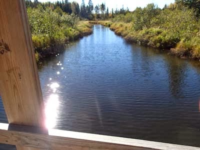
From the A-frame bridge over Sucker River.
I made it through the logging area by dumb luck and persistence. The final crossing of the Sucker River was lovely, and I was proud and pleased to complete my bike-hike circuit.

Apparently, the next section of the SHT has even more logging activity. I'm letting my feet heal, dusting off my GPS, and planning another day in the woods next week.

Saturday, August 24, 2013

Hike to Two Harbors, Leg 5: Lismore Rd to Normanna Rd.

I really wanted to like this hike. Back on my trek to Two Harbors after four weeks off, it should have been good to get off in the woods and put some miles on with the good old Superior Hiking Trail. 6.9 miles in the far outskirts of Duluth could be a decent hiking experience.

I did not like this hike. Chances are, you won't either. Unless you're a committed thru-hiker or a local neighbor looking for a hike, don't bother with this newly-open section of the Superior Hiking Trail.

Normally I look for something positive about every outdoor experience I have. While it might not have been the perfect hike for me, surely there is someone for whom that hike would be absolutely ideal.

The most interesting part of the snowmobile trail.
This section is 6.9 miles long. However, less than two miles of that is actual hiking trail. The rest is either snowmobile trail, ATV trail, or glorified roadwalking. Most of the snowmobile trail is rough walking, with ankle-turning ruts buried under thick grass. The ATV trails were actually a little easier, but I felt totally disoriented as the trails wove past junctions. The ATV trails were, strangely, freshly mowed, as if the trail maintenance crew had just rode past on their John Deere lawnmowers.

There was an occasional view, mostly where the snowmobile trail crossed one of the marshy river areas, like Amity Creek or French River.

I believe the problem is that this trail was trying to be too much. A sign toward the end showed the uses for which the North Shore State Trail is managed. Snowmobiles are obvious. Cross-country skiing? Hard to imagine. Hiking? Well, physically that's possible, but not all that enjoyable. 

My father wants to hike this section. It's the last SHT section he needs to hike. If I can't talk him out of it, at least I'll wait until fall to take him there. There were a few scattered sugar maple and basswood stands, so MAYBE there will be some decent fall colors.

Yes this trail gets you from Point A to Point B. But neither the destination or the journey are worth the buggy boring hassle.

Friday, July 26, 2013

Hiking to Two Harbors, Leg Four: Prindle Road to Lismore Road

Thank you, trailbuilders!

With the young girl and the old man, I completed the fourth leg of my hike to Two Harbors. It was Daphne the poodle and my father, the two of them nearly inseparable the whole way, hiking yesterday from Prindle Road to Lismore Road on the Superior Hiking Trail.

This is a brand-new section of the Superior Hiking Trail, just opened in June. Building a new hiking trail is a rare and beautiful thing. It's a commitment to the future and a gift to the present. The hard work of tree clearing, bridge construction and tread building yields a whole new experience. Like any new trail, this section brings people places they never would have gone before, along a route no one had followed before but is still...just...perfect.

We picked up this section of trail after our brief tour of the English countryside the day before. Here's where the newly-constructed trail splits off from the North Shore snowmobile trail:


After following snowmobile trail for over three miles, it felt great to get back in the woods again. I realized, for the umpteenth time, how different a real hiking trail is. It winds around trees instead of blasting through them. You have to watch your feet and your toes, so you see more of what's right there.The canopy of trees, especially in this young aspen forest, pulls you in like a funnel or a birth canal in reverse.

This is the first real virtuous long-distance hiking since the Superior Hiking Trail left Jay Cooke State Park. There are no campsites in eastern Duluth, so the assumption any thruhikers might sleep illegally or maybe stay in a hotel. Starting at this section, the SHT has trailside campsites every few miles. The Bald Eagle Campsite was one of the scenic highlights of the day, overlooking a beautiful little beaver pond.


Just when you might get sick of thick aspen forests, the trail opens up into a recently-logged area. For about half a mile, the trail runs through thick regrowth. Hats off to the trail building for going through, rather than avoiding, this cut-over area. The sun is nice, and so is the chance to watch nature reclaim this site over time.


This section of trail is great for locals looking to stretch their legs. It's mostly easy walking, just a little hilly at the Lismore Road end. It would be great birdwatching in the spring, with a wide range of habitats and edges. Good job, trailbuilders!

Wednesday, July 24, 2013

Hike to Two Harbors, Leg 3: Martin to Prindle

Dick Slade, Daphne and Hammo
I've never walked in the English countryside. Today was darn close, however. We hiked...er, perambulated...2.5 miles from Martin Road to an unofficial trailhead on Prindle Road, and most of it through lovely farm fields. With my 82-year-old father and his faithful yellow retriever. And my own not quite as faithful poodle. 

My inheritance isn't vast tracts of bucolic estate lands or iconic castles. I inherited from my father a passion for hiking and for obscure long-term goals. Dick wants to have hiked the entire Superior Hiking Trail, and he accomplished that 10 years ago. But they keep adding new trail sections, so every few years we head out and explore the new terrain. I want to hike from Duluth to Two Harbors this year. I'm maybe a fifth of the way there. 

Cue the theme song from Downton Abbey.


British indeed:

Our feet were damp from morning dew in the unmowed grass.

We passed farmers working by hand in their fields.

Old barns loomed over the hills.

Even the names of the landmarks we passed were veddy veddy British: Martin, Amity, Riley, Prindle.

Dick and Andrew Slade at Martin Road trailhead

This stretch of the Superior Hiking Trail is located entirely on the North Shore State Trail. The North Shore State Trail was built for snowmobiling, not hiking. And in winter, this landscape would not be nearly as green or luscious as it was today. Lucky us!

But where were the tea and crumpets when we finished the hike?

Old barn beyond the trail bridge.
The hike to Two Harbors continues tomorrow, from Prindle Road to Lismore Road. No more English countryside, I'm afraid. Just lovely woods, a few deerflies, and one foot in front of another.

Tuesday, July 23, 2013

Hike to Two Harbors, Leg 2: Hartley to Martin

Overlook of Amity Creek valley
My summer hike from Duluth to Two Harbors continued today, two-plus weeks after it started (read about my hike from my house to Hartley here). Today was the shortest stretch of all, from Hartley Park to Martin Road.

It felt great to be out on the trail again. It sounds corny, but the woods and trails are really quiet. And peaceful. Note to self: Hiking is good.


I ended my last hike at the corner of Woodland and Fairmont. Instead of using the Duluth Transit Authority for my shuttle this time, I used my bike. I parked at the Martin Road trailhead, then rode my bike back down Woodland Avenue to Fairmont Street, locked the bike up, and hiked on the "trail" up Carlisle Street.

SHT along Vermilion Road
 Nearly half of this hike was on city streets, though it was mostly quiet back streets. The only car that passed me was on its way to the same trailhead, driven by a mom and two kids off to pick juneberries. The route passes between two cemeteries, well-landscaped park-like settings that just happen to have hundreds of tombstones.

As part of the Superior Hiking Trail, this section is unique and ultimately forgettable. The one big viewpoint into the Amity Creek valley pales in comparison to nearly any viewpoint east or west along the trail. Road walking is tedious. I've commented on this trail section before, even though I hadn't hiked it, when Backpacker Magazine named it one of the 100 best day hikes in the US apparently without actually hiking it.

Pyrola along SHT
But, hey, it's hiking. Hiking is good. All on its own. The sky was blue. It was a cool summer morning with no bugs. There were some lovely pyrola blooming by the trail, as well as cow parsnip and forget-me-not. Even a healthy young birch forest.

So now my journey to Two Harbors has reached the Martin Road trailhead. I have a date with my 82-year-old father to pick up from there tomorrow morning. I know it won't be a glorious climb like Carlton Peak or a challenging roller coaster like the area around Finland. But it will be hiking. And hiking is good.

Monday, July 8, 2013

Hike to Two Harbors: Leg 1, Home to Hartley

 
Okay, there are a few things you should know about me:
  • I really like the idea of Duluth's urban wilderness, of wolves and moose walking our streets and wild places, of vast open forests just beyond city limits. That's what inspired me to move here back in the 1980s, and has kept me here.
  • I like to set modest, attainable goals for myself. I dream way too big, but easily focus on the small.
 Also, you might want to know that as of June 1, 2013, the Superior Hiking Trail runs continuously from Duluth to Two Harbors. Well, actually it runs all the way to Canada, but the big news of this summer is that with two new sections basically the entire trail is complete.

A lot of folks take off every year to thru-hike the Superior Hiking Trail. Even more folks try to thru-hike far longer trails, like the Appalachian Trail or the Pacific Crest Trail. My modest and attainable goal for this summer is to hike all the way from Duluth to Two Harbors on the Superior Hiking Trail, as my little way to celebrate the long-awaited completion of the Trail.

I started this weekend with my first leg, 6.5 miles from my house in Duluth to Hartley Nature Center. The first mile or so of my journey was along the Downtown Lakewalk. No, that is not me in the picture below. Yes I was hiking alone, but I was in a much better mood than this guy.


While this is the Superior Hiking Trail, it is not anything like the rest of the Superior Hiking Trail. The only similarity was the signage along the way. Here's the sign pointing the route of the "Trail" up Duluth's 14th Avenue East:


The trail starts to get wooded and rugged (like the rest of the Superior Hiking Trail) when it crosses Fourth Street and enters Chester Park. While I could have stopped in at Burrito Union for sustenance, I plugged on. For almost a mile, the trail climbs up the west side of the creek, under towering white pines, past dramatic little waterfalls, and away from city noises.

Climbing out of the Chester Creek valley, there's another half-mile or so on city sidewalks before the Superior Hiking Trail enters UMD's Bagley Nature Area. There I enjoyed the sturdy metal deck on top of the old downhill ski run. I could see all the way back to Park Point, where my hike had begun an hour and a half earlier.

The most natural and remote part of the hike was through Hartley Nature Center. Not coincidentally, this was the first stretch of trail I'd been on that day that had been built specifically to be the Superior Hiking Trail. Everything else had been existing trails that had been connected simply by putting up the signs. 


The trail popped out of the woods at Hartley Pond and finished up down at the Hartley Nature Center building. From there it was a short walk up to Woodland Avenue and the Duluth Transit Authority bus stop. 75 cents and a 30-minute ride on the Route 13 bus brought me back downtown and a short stroll back over the Lift Bridge and home again.

The whole experience, including the bus shuttle back home, took three and a half hours. It's not the most scenic stretch of the Superior Hiking Trail and it might just be the busiest stretch. It was a great way to shake out my hiking legs and get ready for the many miles ahead on my modest, attainable goal.

Monday, October 1, 2012

Great fall walking on West Skyline Parkway

Some of the best fall colors in the North Shore area right now are along Duluth's western Skyline Parkway. Thanks to June's floods, a whole long stretch of that scenic byway is closed to automobiles, making it PERFECT for a stroll through a colorful northern hardwood forest.

If you drive Interstate 35 to Exit 249 (Boundary Avenue and Spirit Mountain), follow the signs for Skyline Drive toward Spirit Mountain and continue past Spirit for a total of 2.2 miles from Interstate 35. At that point, the road simply stops at a barricade. Here you can park your car and start walking. 

Skyline Parkway bridge out
In just a few yards, you can see exactly why the road is closed. Right before the landmark dragon bridge you'll find a maze of gullies and channels where the floodwaters crossed the boulevard and wiped out the roadway. 

Press on through this eroded area and you'll be back on a wide, very walkable gravel road you can follow all the way to the scenic overlook at Bardons Peak. The road is closed at the far end too, so there should be no cars on this stretch.

skyline maple duluth
The sugar maple trees are red and orange, the birch trees are all yellow. Other trees like ironwood and sumac have amazing deep red colors. 

SHT blaze Duluth
If you'd like a little variety in your outing, you can try a short and dramatic stretch of the Superior Hiking Trail. About 200 yards on the left past the dragon bridge, there's a big trailhead parking lot for the Superior Hiking Trail. It's empty now because no cars can get here. If you get on the Superior Hiking Trail at the trailhead, you can take it west for just about a half mile, through lovely woods where glowing maples mix with tall white pine. There's a cool crossing of Snively Creek and a great overlook of western Duluth neighborhoods. The Superior Hiking Trail returns to Skyline Parkway, and you can get back on the wide and easy road again.

Wednesday, September 26, 2012

Love on the Superior Hiking Trail


poplar river superior hiking trail lutsen 
"This is one of my favorite sections." Only for a old hiking couple like us could that have been words of love. 

When Sally said just that to me this week as we hiked from the Caribou Trail to Lutsen on the Superior Hiking Trail, I felt as warm and gooey as if she'd reached across a fancy restaurant's white linen to hold my hand. She likes it. She really really likes it! I'd wrapped up a virtual present for her and she was delighted with it.

We'd already enshrined this hike as one of the "50 fabulous day hikes" in our book Hiking the North Shore. But it was Sally's first time on this particular section of the Superior Hiking Trail, and...she likes it! We'd sent our kids off to school in the morning, zipped up the shore, and now we were back in our element.

We weren't the only couple appreciating the trail. It seemed like everyone else on the trail was a couple, mostly a man and a woman, once a woman and her dog. It was like that old tourism ad for the Commonwealth of Virginia, "Virginia is for Lovers." New marketing slogan: "The Superior Hiking Trail is for lovers." Who else would be out on a longer hike during the school week at the peak of fall colors?

Andrew poodle lutsen overlook
Of course this was a work trip as well as a date, so I took careful notes of the book's description and where we could improve it. Sally wasn't the only girl who liked the day's adventure; the poodle Daphne was pretty into it too. Except when the wolf scat on the trail was fresh, and then she'd tuck her tail in and carefully follow right in my footsteps. 

Hike summary
This is a 6.4 mile one-way hike from the Caribou Trail west on the Superior Hiking Trail to Lutsen Mountain. It's Hike 36 in our book. The best way to do this is by arranging a shuttle, so you can hike back to Lutsen for your car or your hotel room. (Or see below for reserving a spot on the Superior Shuttle.)

Finding the trailhead 
From Highway 61 mile marker 92.0, take County Road 4 (the Caribou Trail) 4.1 miles to the Superior Hiking Trail parking lot just off the road on the right, at the Caribou Lake boat launch.

The hike starts with an short optional spur to White Sky Rock, a lovely overlook of Caribou Lake. From there, it's a walk through cedar forest and rock formations to Lake Agnes, Caribou Lake's wild and undeveloped sister.
Lake Agnes SHT hunters rock
The whole 6.4 miles is fairly level overall, with stretches on top of maple-rich ridges alternating with  stretches in conifer-dense lowlands. After passing Lake Agnes, the trail reaches a series of three dramatic overlooks of the Poplar River valley, including a lovely view of curves in the river. In this week's fall colors, the entire scene was just breathtaking.

After the three big overlooks, the trail descends to the river valley and a long stretch of thick woods. Soon enough though you're hiking alongside the Poplar River as it turns from a sedate curvy quiet stream into a classic North Shore rushing river. Then it's another climb to Glove Overlook, where you can look back at the land you've crossed, and more beautiful maple woods. Finally it's a rocky descent back to the river and the busy world of Lutsen Mountain ski area. 

As we finished that last downhill, we passed an older couple, even older than us. They asked us to take their pictures. We guessed later that they were newlyweds, exploring the North Shore and getting to know each other in a new and beautiful place. Sort of like us, I guess. Yes, the Superior Hiking Trail is for lovers. 

Use the Superior Shuttle if you're hiking solo
This hike is great for a one-way hike from east to west. You can use the Superior Shuttle service. The shuttle will pick you up at 10:54 AM by the Lutsen gondola and drive you to the Caribou Trail trailhead (weekends only). Reservations are strongly recommended in the busy fall colors season. 

If you're staying at one of the local resorts at Lutsen Mountain, check at the front desk to see if they'll drive you and your partner (human or dog) to the Caribou Trail trailhead.

Monday, April 30, 2012

Great guided hikes on the Superior Hiking Trail

Small group of hikers on the Tofte Overlook, Carlton Peak.
Have you always wanted to hike the Superior Hiking Trail, but never felt quite ready? Maybe you heard about how difficult it can be, or maybe you heard one of the rare stories of people getting lost on the trail. 

Fear not! If you can follow driving directions to a trailhead, you can join a guided hike this spring, summer or fall on the Superior Hiking Trail. 

These guided hikes are a great way to get out on an excellent hiking trail. There is truly safety in numbers, and each hike has both a hike leader and a person bringing up the rear (the "sweep"). The hikes all meet at the trailhead where the hike will finish. Then the hikers carpool to the starting trailhead and walk back to their cars.

No need to find your own way on a SHTA guided hike!
The next guided hike on the "SHT" is this Friday, May 4, on a new section of trail deep in the woods between Duluth and Two Harbors. It's a 5.1-mile hike crossing the Sucker River. At 1:00, meet at the Fox Farm Road Trailhead. Like all SHT guided hikes, this one is FREE.

The trailhead is about 8 miles inland from the Highway 61 expressway. Full driving directions are on the flier for the Superior Hiking Trail Association's annual meeting.That same flier has information on five other guided hikes coming up this weekend for the annual meeting, all up in the Little Marais and Schroeder area.

Duluth-area hikers should mark their calendars for Saturday, May 12, when there's another free guided hike on the SHT between Jay Cooke State Park and the Elys Peak area in far western Duluth. Meet at the 123rd Avenue West SHT trailhead. Driving directions to that trailhead are here. It's a 6.9 mile hike that should be full of spring wildflowers.

Monday, September 19, 2011

Get ready for fall colors

Fall color tapestry below Sawmill Dome, September 2010
The best time for hiking the North Shore is here. Clear your calendars for some adventurous treks through lovely forests with the best Lake Superior views of the year.

Bean Lake in a bowl of fall colors/
Be sure to head for one of the great ridgeline overlooks. On one side, Lake Superior glimmers in a deep dark blue. On the other side, a tapestry of color spreads out beneath you. Some of my favorite fall color overlooks are on Oberg Mountain, Leveaux Mountain, and Sawmill Dome.  

The birch trees are already changing at North Shore state parks. Head seven miles in from Finland on Lake County Road 7 to explore George H. Crosby-Manitou State Park and the Yellow Birch Trail, which should be lovely this next week. Smoke from the Pagami Creek fire may be blowing that way, so be ready to shift plans east or west depending on the wind conditions.

The Minnesota Department of Natural Resources predicts an excellent fall color season. Drought in the Ely area has triggered early colors in the region’s birch trees. Check on the latest fall colors with a report from the DNR.

Monday, September 5, 2011

Best Duluth hikes by bus

Getting to a great North Shore hike can mean as much driving as hiking. It's a pretty good haul up the Onion River Road or all the way to Grand Portage for your outdoor experience. 


Not so for hikers in Duluth. Just walk to the corner, hop on the Duluth Transit Authority bus, then ring the dinger for your trailhead bus stop.

From downtown Duluth, you can catch the #3 bus going west toward Proctor. 30 minutes and a few quarters for the bus fare later, and you're at the corner of Highland Street and Skyline Drive. It's a rugged nine mile hike on the Superior Hiking Trail along scenic Peace Ridge and past Enger Tower back to downtown.

Or hop on the #13 bus headed up Woodland and ride all the way to Hartley Nature Center, about a 25 minute trip. Then hike back to downtown via Hartley, UMD's Bagley Nature Area, Chester Creek and the Lakewalk, 4.5 miles all on the Superior Hiking Trail.

One more trip from downtown Duluth: you can take the #15 bus from downtown all the way to the Park Point Recreation Area. From there, you can either hike past the airport into the pine forest and the Superior Entry, or you can walk the gorgeous sand beach all the way back to Canal Park.

For more information on any of these hikes, check out my book:
Hiking the North Shore: 50 Fabulous Day Hikes in Minnesota's Spectacular Lake Superior Region (There & Back Guides)

Tuesday, August 2, 2011

On the road with Sam Cook

Chris Evavold being photographed by Sam Cook at Divide Lake
Every two or three years, the phone rings and a familiar voice with just a hint of Kansas in it says, "Hi, Andrew, Sam Cook." Just like the sound of a bell got Pavlov's dogs to salivate, that voice makes me start to stuff my day pack. We're going on an adventure.

Sam wanted to do an article about North Shore hiking and our new book, Hiking the North Shore: 50 fabulous day hikes in Minnesota's spectacular Lake Superior region. "Where would you like to go, Andrew?," Sam asked. What a great question to get!

Sam was looking for something different. The day would be hot, so it would be good to be near a lake. He'd done a lot on the Superior Hiking Trail. He wanted to bring his lab, Lucy. Fortunately, I had the perfect hikes for him. And the perfect hiking companion.

Eighteen Lake and Divide Lake are both in the Superior National Forest, just east of Isabella off Highway One. They both have hiking trails around the shore, 2.7 miles at Eighteen Lake and 2.1 at Divide Lake. In the National Forest, dogs can run free off leash. And Divide Lake is a trout lake, which was perfect for my old friend Chris Evavold. 
Pipsissewa in bloom along Divide Lake trail
Chris, Sam and I met in Duluth and headed up Highway 61 to Illgen City. I drove Sam's minivan so he could ask me questions and jot down notes in his classic narrow reporter's notebook. I was ready: "What's so great about hiking here?" "Why did you want to write this book?"

At Illgen City I checked my watch. The "Lake Superior region" in the subtitle of my book roughly means anywhere you can reach within one half hour of driving from Highway 61. It was 32 minutes up Highway One to Divide Lake. Phew!

Hiking (or skiing, or snowshoeing, which I've done with him for other articles) with Sam is a moving chat fest in the woods. Much of the conversation is off the record and only distantly related to the story at hand. But every few moments, Sam would either dash ahead to get photos of Chris and me, or lag behind to write in his notebook.

The hikes were scenic and a lot of fun. Divide Lake is more for anglers and naturalists, with interesting botany and (supposedly) trout in the lake. Eighteen Lake is great for hiking, with lovely pine forests and dramatic views up and down the wild lake.
After the hike around Eighteen Lake, Sam got "head shots" of Chris and me. We were into the heat of the day, so before we headed back to Duluth we went for a refreshing swim in the cool lake waters. Just what the reporter ordered.

Here's the article. There's some good related content, too. See you out there!

Thursday, July 14, 2011

Hiking and herring: Celebrate Lake Superior Day

Happy Lake Superior Day! Time to head up the shore for a scenic hike, a dip in the lake, and some good fresh Lake Superior fish. 
For about 20 years now, fans of Lake Superior have taken the third Sunday of July as Lake Superior Day to celebrate the world's largest freshwater lake. Fun educational events are scheduled up and down the North Shore. Events are great, but be sure to have your own Superior celebration.


Make your own celebration with a Superior hike
 
Carlton Peak is a challenging, fun hike you can take all the way from the shore of Lake Superior to one of the highest points and biggest views on the North Shore. Drive to the Highway 61 parking lots of Temperance River State Park, between Schroeder and Tofte at mile marker 80.3. You'll follow the Superior Hiking Trail up the amazing gorge of the Temperance River and then a long steady climb up to the stony knob of the peak. It's 3.5 miles in to the peak with 900 vertical feet to gain. The big views up and down the shore from the summit are the perfect reward for the long hike up. 

You'll be hot when you get back to Highway 61, so finish your Lake Superior Day hike by dipping your toes...or even your whole body...in the lake itself. Although the park is closed to vehicles, you can still follow the trails down the west side of the river to the beach area. 
Hungry for herring
Feeling refreshed...and hungry, head for Satellite's Country Inn about eight miles west of Temperance. This is a true mom-and-pop restaurant, with home-made pies on the plate and local history artifacts on the walls. But what makes this THE spot in western Cook County for Lake Superior Day are the fishcakes, made with local, fresh-caught lake herring.
Happy, happy Lake Superior Day!

Tuesday, May 17, 2011

Go soon to see the "flowers of the day"

Hepatica on the Superior Hiking Trail in western Duluth, 5/15/2011
The spring ephemerals are blooming in the woods of the North Shore. Ephemeral is a lovely word from the Greek words for "of the day." It means short-lived, and these flowers pack a lot of living into just a very few days. 

Along the Superior Hiking Trail, in the Bardon Peak area of western Duluth off Skyline Drive, there is a great two miles of trail leading through the heart of an old-growth northern hardwood forest. 

Bloodroot along the Superior Hiking Trail in western Duluth, 5/15/2011

There is a very brief window of opportunity for the flowers there: the ground must be thawed, and there must be plenty of sunshine. "Spring ephemerals" are a small group of flowers that carry out virtually their entire annual life cycle in those few weeks. In that group are bloodroot, hepatica, wood anemone, and spring beauty. 

Well, the ground is thawed, and thanks to our long winter there are very few leaves on the trees to block the sun. So this is the time to head to your favorite stretch of maple forest and check out the show.

Go see for yourself
This is Hike 3 in our new book Hiking the North Shore. 

To reach the Bardon Peak trail, take Skyline Drive west from I-35 past Spirit Mountain. It's 2.5 miles to the Magney Ski Trail parking area. The Superior Hiking Trail leads from the near corner of the parking lot. Take a right at the first junction and follow the signs for Bardon Peak. After a scenic run across a creek and through a pine forest, the trail crosses Skyline Drive and enters the old-growth maple forest. It's 1.3 miles total to the big viewpoints of Bardon Peak. You can either continue for a total of 3.3 miles to Elys Peak or turn around here.

Bloodroot and hepatic were blooming a few days ago, but very soon the lovely large-flowered trillium will be blooming too. Get out there and enjoy!