Monday, October 28, 2013

Stay safe this North Shore deer season

From http://www.fs.usda.gov/detail/conf/learning/safety-ethics/?cid=FSM9_029237

For a few weeks every year, the North Shore fills with hunters. While I'm glad those hunters are out there controlling the deer herd, I also know to change my outdoor plans dramatically. You can still hike and explore the North Shore, you just have to plan ahead. 

Firearm deer season starts in about ten days, on Saturday, November 9, and runs to Sunday November 24. That stretch of days includes three weekends in a row. If you've been meaning to get out in the woods for one more fall hike, one last mushroom expedition, one special picnic, now is the time to do it.

Grouse season is already underway, so many of the local trails have hunters on them. But those hunters are using shotguns and dogs; you'll see them coming and there's little danger of a stray bullet.

Deer season in the state parks
When deer season starts up, you can still find public places to get out and explore nature. Most of the North Shore state parks ban deer hunting in their most popular areas. SOme of them ban non-hunters from their backcountry. It's safe to say there won't be deer stands propped up on the Jay Cooke Swinging Bridge.

From Jay Cooke to Grand Portage, here's a brief review of state park status:
  • Jay Cooke: No hunting during regular deer season. Special muzzleloader season December 7-11.
  • Gooseberry Falls: All park land between Highway 61 and the lakeshore is safe from hunting.
  • Split Rock Lighthouse: All park land between Highway 61 and the lakeshore is open for visitors and closed to hunting.
  • Tettegouche: All park land between Highway 61 and the lakeshore is open for visitors and closed to hunting.
  • Cascade River: Most of the lakeshore, campground and waterfalls ares is closed to hunting and open to visitors. Consult a map at the park to make sure.
  • Judge CR Magney: Stay away if you're not hunting. Hunting is banned in the campground area, but everything else is open for hunting, including the hike to Devil's Kettle. 
  • Grand Portage: Safe zone; there is no deer hunting in this state park. 
Deer season on the Superior Hiking Trail
Much of the SHT is closed during deer season to respect the local landowners the trail passes. The trail will be closed from the northern edge of Duluth all the way through Lake County to the Sugarloaf Road for the entire season. Stretches of trail in Cook County will be closed as well. Check the SHTA Conditions webpage for more details.

Anywhere in deer season
If you do go out on the trails, wear blaze orange. If you don't have any, you can stop at a local convenience store or sporting goods store and buy a stylish orange wool cap or a cheap orange plastic vest.

What are your tips for a safe and enjoyable North Shore deer season?

Friday, October 11, 2013

North Shore fall colors: Past their peak

Twice in the last two days I've driven from Duluth up to the middle of the North Shore. On Thursday, we were actually looking for fall colors and a glorious hike. Today it was just for a meeting, but I kept my eyes out.

Here's my blow-by-blow, tree-by-tree analysis:

Maples: 
Pool in a woodland stream, Section 13 hike
The famed sugar maple forests of the North Shore ridgelines are nearly done. Entire hillsides of maple trees are barren. Yellow maple leaves carpet the forest floors. Some smaller maples, tucked into the protection of a forest, still have some yellow leaves. Driving through Finland, there was hardly a colored maple leaf left on the trees.

Ironically, there is one glorious orange maple right by the highway where it passes through Gooseberry Falls State Park. Don't let this tree, obviously planted by a landscaper, fool you. The maple season in the heart of the North Shore is nearly over.

Oaks: 
Red oak leaves, Section 13 trail
 Most of the red colors in the inland areas, like on our hike yesterday to Section 13, were on the red oak trees. The red of red oak leaves can be luscious, like lipstick. The oaks tend to stand by themselves in rockier, shallower soil, not in thick groves like the maple. So each colorful oak tree really popped.

Aspen:
Aspens glow yellow, oaks red below Section 13 cliffs
Along Highway 61, clusters of aspen ranged from fully green-leaved to completely empty of leaves. Their color gets better the further we went up the shore. Many solo aspens along the highway and on the hillsides were glorious fountains of golden yellow.

Birch:
What birch? Especially along Highway 61, the birch are virtually all died out. Their white bark still stands, providing nice contrast to the other, still living trees.

If you're looking for fall colors this week, I'd recommend sticking to the Highway 61 corridor. Go for a walk on the ski trails at Split Rock Lighthouse State Park. Hit the Superior Hiking Trail to Elys Peak in the western part of Duluth. There's still lots of lovely autumn out there still, you just might have to look for it.

Saturday, October 5, 2013

Hiking to Two Harbors, Leg 6: Normanna Rd. to Sucker River

A welcome sign at the Normanna trailhead
I played hooky this week and got back on the Superior Hiking Trail. I wanted to make some progress on my big "summer" goal of hiking all the way to Two Harbors. Five day hikes in, I had made it to Normanna Road, on the northeast outskirts of Duluth.

After hiking on everything from city sidewalks to snowmobile trails, after hiking through everything from farmfields to graveyards, after hiking with everything from baby strollers to ATV's, I was thrilled to be on a real hiking trail. This section of the SHT is nine miles long. On this hike from Duluth to Two Harbors, this was the first pure and simple hike, just foot travel, no wide snowmobile trails or paved walkways.

Me in some maple woods
Just a few hundred yards in, I had to literally stop and tighten my boot laces. On a classic SHT layout, the trail winds up and over woodland ridges, over boulders, down steep streambanks, and more. For the first time in a long run of hiking trail, I actually had to hike.I loved it.

The SHT here is nearly all on state or county forest land. Some of the highlights along the trail section are beaver ponds and the open beaver meadows, a classic North Shore ridgeline maple forest, just starting to turn yellow and orange, and the scenic gurgles of the Sucker River.


Even the older logged areas, cut over two or three years ago, had some beautiful fall flowers.

Asters blooming in October in a logged area

Nine miles is a decently long hike, and I was starting to feel the wear in my joints toward the end. I had driven to the ending trailhead on Fox Farm Road and ridden my bike nearly ten miles along dirt and paved road to the starting trailhead, so I had already pushed my middle-aged body more than I would at a typical day at the office.

So just when I felt I was in my little hiking nirvana...

The SHT goes straight through that brush pile

A bit tired, a bit elated from actually hiking in actual woods, I was thrown off my game in the last mile, as the trail entered an active logging area. I'd heard the rumble of engines and the hum of saws for a good half hour. Then the SHT ran right into an opening that, based on the smell of sawdust and equipments, had probably been cut in the last 48 hours. The only sign of the SHT was the occasional strip of pink flagging on the small trees left standing.

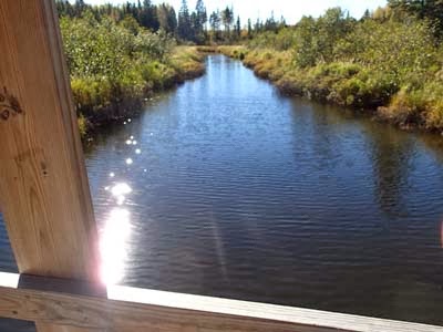
From the A-frame bridge over Sucker River.
I made it through the logging area by dumb luck and persistence. The final crossing of the Sucker River was lovely, and I was proud and pleased to complete my bike-hike circuit.

Apparently, the next section of the SHT has even more logging activity. I'm letting my feet heal, dusting off my GPS, and planning another day in the woods next week.

Monday, September 30, 2013

Twin Lakes Trail: A blast from the past

I've been stuck in Duluth this last week or so, wishing I could be out hiking in the fall colors. I hear the colors are near peak. I thought I'd repost a blog entry about one of the best fall color hikes on the shore. Enjoy! Andrew


One of the best hikes on the North Shore is the Twin Lakes Trail, also known as the Bean and Bear Lakes hike. Most people hike to Bean Lake on the Superior Hiking Trail, off of Penn Boulevard. The Twin Lakes Trail has its own trailhead, right in town in Silver Bay. I think this access is more wild and more interesting.

The hike is 6.8 miles long and involves some pretty good climbing, so it's not suited for young children. Pack a lunch, too. Not only will you need the calories, but there are three really great lunch spots to sit and enjoy the meal with a view.

You'll find the Twin Lakes Trail trailhead 0.3 miles up from the Highway 61 Silver Bay stoplights up Outer Drive. The parking lot is also for the visitor information center run by the Bay Area Historical Society. From the corner of the parking lot, the trail follows a wide gravel ATV trail for about 0.3 miles. Then the hiking trail cuts to the right off the ATV trail.

Silver Bay was the center of the damage from the April ice storm. This trail had been hit hard, by falling trees and broken branches. But the trail crews had cleared nearly the entire loop. THANK YOU TRAIL CREWS!!


It's a lollipop loop, so you'll hike up 1.8 miles on the "stick" of the lollipop. That gets you to the crux move. Left or right?


I enjoyed going left and hiking clockwise around the 3.1 mile main loop.

Some highlights, in hiking order:

1) The view from the top of Elam's Knob, as the town of Silver Bay gets swallowed by the hills and forest and lake:


2) The dramatic cliffs and far-below views of Bean Lake:


3) The full view of Bear (close) and Bean (far) lakes:


It's a great hike anytime of year. At least half of the hike is in maple woods, so it's gorgeous in the fall. The spring wildflowers were nice this week.

Get out and go wild!

Wednesday, September 18, 2013

Dry Lake day hike: Easier in Ely


Dry Lake sits a few miles north of Ely, just off the Echo Trail. A Superior National Forest trail circles the lake. The Dry Lake Trail shares the same parking lot and some of the same trail as the popular Bass Lake Trail, a six-plus mile circumnavigation of Bass Lake. In comparison, the three-mile Dry Lake Trail packs more scenery per mile and yet has fewer hikers.


In the last year, the Superior National Forest has significantly improved the signage for the Dry Lake and Bass Lake trails, with accurate new maps at virtually every trail junction. The trail itself is fairly well maintained, with bridges over the creeks. There does always seem to be at least one tree down across the trail when I'm there, though.

The hike starts with a short approach to the loop. Watch for signage as the trail turns off a wide snowmobile trail onto a more rugged hiking trail, then climbs to the top of a high bluff. I always hike this trail clockwise, taking the left fork at what is now Junction 2. No particular reason for that, just habit.

The trail soon reaches Little Dry Lake. The most rugged part of the hike is along the north shore of Little Dry Lake, where the glaciers left a big rugged pile of cobblestone. A thick crop of poison ivy grows alongside the trail.


One of the scenic highlight is the high rocky bluff above the west shore of Dry Lake. There is no development on Dry Lake, just wild open public land, so stop for a nice long break at the bluff, marked on the maps as a scenic spot.

Another scenic highlight is Dry Falls. This is where the water from Dry Lake empties into Bass Lake.

From Dry Falls, it's a dramatic one-mile hike back to the parking area on the Echo Trail, along a pine-studded ridgeline with great views above and small patches of wintergreen below.

If you're in Ely and looking for an moderate half-day hike, you can't go wrong with the Dry Lake Trail.

Saturday, August 24, 2013

Hike to Two Harbors, Leg 5: Lismore Rd to Normanna Rd.

I really wanted to like this hike. Back on my trek to Two Harbors after four weeks off, it should have been good to get off in the woods and put some miles on with the good old Superior Hiking Trail. 6.9 miles in the far outskirts of Duluth could be a decent hiking experience.

I did not like this hike. Chances are, you won't either. Unless you're a committed thru-hiker or a local neighbor looking for a hike, don't bother with this newly-open section of the Superior Hiking Trail.

Normally I look for something positive about every outdoor experience I have. While it might not have been the perfect hike for me, surely there is someone for whom that hike would be absolutely ideal.

The most interesting part of the snowmobile trail.
This section is 6.9 miles long. However, less than two miles of that is actual hiking trail. The rest is either snowmobile trail, ATV trail, or glorified roadwalking. Most of the snowmobile trail is rough walking, with ankle-turning ruts buried under thick grass. The ATV trails were actually a little easier, but I felt totally disoriented as the trails wove past junctions. The ATV trails were, strangely, freshly mowed, as if the trail maintenance crew had just rode past on their John Deere lawnmowers.

There was an occasional view, mostly where the snowmobile trail crossed one of the marshy river areas, like Amity Creek or French River.

I believe the problem is that this trail was trying to be too much. A sign toward the end showed the uses for which the North Shore State Trail is managed. Snowmobiles are obvious. Cross-country skiing? Hard to imagine. Hiking? Well, physically that's possible, but not all that enjoyable. 

My father wants to hike this section. It's the last SHT section he needs to hike. If I can't talk him out of it, at least I'll wait until fall to take him there. There were a few scattered sugar maple and basswood stands, so MAYBE there will be some decent fall colors.

Yes this trail gets you from Point A to Point B. But neither the destination or the journey are worth the buggy boring hassle.

Monday, August 12, 2013

Get picking: it's blueberry time

I have lost touch with reality. As reports came in of wild blueberries all over the Gunflint Trail and the North Shore, I stayed home waiting for news from somewhere else...the South Shore. This weekend, we went to Blue Vista Farm in Bayfield and picked about two gallons of big, beautiful blueberries. No bug bites. No scratches from the hike in. No sore back from bending down or sitting on lichen-covered rocks.


Commercial pick-your-own berry farms are about quantity over quality. Domestic berries don't have the exquisite taste of wild berries. But you can fill your flat in less than an hour of picking.


Every farm product, from spinach to sweet corn, is late this year. South Shore berry farms are typically ready about two weeks before berry farms in the Duluth and North Shore area. So local Minnesota berries are just getting ready. For a week or two here in mid-August, there are commercial berries anywhere you go.

Where to pick
In Wisconsin
We're big fans of Blue Vista Farms in Bayfield. They have both organic and nonorganic berries, in a lovely old farmstead up in the hills over that great harbor town. Here's a link to all of Bayfield's orchards and berry farms.

In Minnesota
The biggest pick-your-own blueberry farm in the Duluth/North Shore area is Blackbirds and Blueberries, just east of Cloquet. Like many berry farms, they use Facebook to get the word out about picking times. It's always a good time out there as people from all over the region fill the fields and collect their buckets of blue joy. I've blogged about Blackbirds and Blueberries here.

A little off the beaten path but definitely more "North Shore" is Sherry's Berries, in Alden Township inland from Lake Superior between Duluth and Two Harbors. Sherry's is small and personal, with certified organic berries. Call ahead to reserve a picking time and to get directions. Read my blog entry from last year about Sherry's.

Whether it's on a rocky outcrop of the Superior Hiking Trail or a plush farm field in Wisconsin, picking blueberries connects you, body and soul, with wonderful wild places of the Lake Superior region.

Friday, July 26, 2013

Hiking to Two Harbors, Leg Four: Prindle Road to Lismore Road

Thank you, trailbuilders!

With the young girl and the old man, I completed the fourth leg of my hike to Two Harbors. It was Daphne the poodle and my father, the two of them nearly inseparable the whole way, hiking yesterday from Prindle Road to Lismore Road on the Superior Hiking Trail.

This is a brand-new section of the Superior Hiking Trail, just opened in June. Building a new hiking trail is a rare and beautiful thing. It's a commitment to the future and a gift to the present. The hard work of tree clearing, bridge construction and tread building yields a whole new experience. Like any new trail, this section brings people places they never would have gone before, along a route no one had followed before but is still...just...perfect.

We picked up this section of trail after our brief tour of the English countryside the day before. Here's where the newly-constructed trail splits off from the North Shore snowmobile trail:


After following snowmobile trail for over three miles, it felt great to get back in the woods again. I realized, for the umpteenth time, how different a real hiking trail is. It winds around trees instead of blasting through them. You have to watch your feet and your toes, so you see more of what's right there.The canopy of trees, especially in this young aspen forest, pulls you in like a funnel or a birth canal in reverse.

This is the first real virtuous long-distance hiking since the Superior Hiking Trail left Jay Cooke State Park. There are no campsites in eastern Duluth, so the assumption any thruhikers might sleep illegally or maybe stay in a hotel. Starting at this section, the SHT has trailside campsites every few miles. The Bald Eagle Campsite was one of the scenic highlights of the day, overlooking a beautiful little beaver pond.


Just when you might get sick of thick aspen forests, the trail opens up into a recently-logged area. For about half a mile, the trail runs through thick regrowth. Hats off to the trail building for going through, rather than avoiding, this cut-over area. The sun is nice, and so is the chance to watch nature reclaim this site over time.


This section of trail is great for locals looking to stretch their legs. It's mostly easy walking, just a little hilly at the Lismore Road end. It would be great birdwatching in the spring, with a wide range of habitats and edges. Good job, trailbuilders!

Wednesday, July 24, 2013

Hike to Two Harbors, Leg 3: Martin to Prindle

Dick Slade, Daphne and Hammo
I've never walked in the English countryside. Today was darn close, however. We hiked...er, perambulated...2.5 miles from Martin Road to an unofficial trailhead on Prindle Road, and most of it through lovely farm fields. With my 82-year-old father and his faithful yellow retriever. And my own not quite as faithful poodle. 

My inheritance isn't vast tracts of bucolic estate lands or iconic castles. I inherited from my father a passion for hiking and for obscure long-term goals. Dick wants to have hiked the entire Superior Hiking Trail, and he accomplished that 10 years ago. But they keep adding new trail sections, so every few years we head out and explore the new terrain. I want to hike from Duluth to Two Harbors this year. I'm maybe a fifth of the way there. 

Cue the theme song from Downton Abbey.


British indeed:

Our feet were damp from morning dew in the unmowed grass.

We passed farmers working by hand in their fields.

Old barns loomed over the hills.

Even the names of the landmarks we passed were veddy veddy British: Martin, Amity, Riley, Prindle.

Dick and Andrew Slade at Martin Road trailhead

This stretch of the Superior Hiking Trail is located entirely on the North Shore State Trail. The North Shore State Trail was built for snowmobiling, not hiking. And in winter, this landscape would not be nearly as green or luscious as it was today. Lucky us!

But where were the tea and crumpets when we finished the hike?

Old barn beyond the trail bridge.
The hike to Two Harbors continues tomorrow, from Prindle Road to Lismore Road. No more English countryside, I'm afraid. Just lovely woods, a few deerflies, and one foot in front of another.

Tuesday, July 23, 2013

Hike to Two Harbors, Leg 2: Hartley to Martin

Overlook of Amity Creek valley
My summer hike from Duluth to Two Harbors continued today, two-plus weeks after it started (read about my hike from my house to Hartley here). Today was the shortest stretch of all, from Hartley Park to Martin Road.

It felt great to be out on the trail again. It sounds corny, but the woods and trails are really quiet. And peaceful. Note to self: Hiking is good.


I ended my last hike at the corner of Woodland and Fairmont. Instead of using the Duluth Transit Authority for my shuttle this time, I used my bike. I parked at the Martin Road trailhead, then rode my bike back down Woodland Avenue to Fairmont Street, locked the bike up, and hiked on the "trail" up Carlisle Street.

SHT along Vermilion Road
 Nearly half of this hike was on city streets, though it was mostly quiet back streets. The only car that passed me was on its way to the same trailhead, driven by a mom and two kids off to pick juneberries. The route passes between two cemeteries, well-landscaped park-like settings that just happen to have hundreds of tombstones.

As part of the Superior Hiking Trail, this section is unique and ultimately forgettable. The one big viewpoint into the Amity Creek valley pales in comparison to nearly any viewpoint east or west along the trail. Road walking is tedious. I've commented on this trail section before, even though I hadn't hiked it, when Backpacker Magazine named it one of the 100 best day hikes in the US apparently without actually hiking it.

Pyrola along SHT
But, hey, it's hiking. Hiking is good. All on its own. The sky was blue. It was a cool summer morning with no bugs. There were some lovely pyrola blooming by the trail, as well as cow parsnip and forget-me-not. Even a healthy young birch forest.

So now my journey to Two Harbors has reached the Martin Road trailhead. I have a date with my 82-year-old father to pick up from there tomorrow morning. I know it won't be a glorious climb like Carlton Peak or a challenging roller coaster like the area around Finland. But it will be hiking. And hiking is good.

Monday, July 22, 2013

Berry picking: Better late than never

Fresh berries in the straw.
Nothing tastes more like a Northland summer than a freshly-picked strawberry. The more juices running down your chin the better. After weeks of painful delay, pick-your-own berry season is underway.

Kids picking strawberries in the field at Finke's
Last year the strawberry season was almost a complete washout. With a late spring frost followed by mold-inducing June floods, the harvest was less than a quarter of what it could have been.

This year's harvest is late but bountiful. We went to Finke's Berry Farm late last week, about forty minutes south of Duluth and just off I-35, and picked four gallons of lush, ripe strawberries. One hot night in the kitchen later, we have a stockpile of delicious natural strawberry jam ready for a year full of PB&J's.

This was a few days ago, more like 14 picking days remain now.
For more information on picking at Finke's, "Like" them on Facebook. That way you'll get the latest updates on picking times. Oh, and those in the know call them "Fink's", not "Fink-ee's"

The other local strawberry pick-your-own farm is in Oulu, Wisconsin. Johnsons Berry Patch saved my summer and our kids' lunches last year after other local strawberry farms got washed out. Johnson's has been growing strawberries since 1951 and are not quite as modern as Finke's. So no Facebook page. All I could find online is this description. It is a lovely drive out past Brule and along a charming backroad.

Monday, July 8, 2013

Hike to Two Harbors: Leg 1, Home to Hartley

 
Okay, there are a few things you should know about me:
  • I really like the idea of Duluth's urban wilderness, of wolves and moose walking our streets and wild places, of vast open forests just beyond city limits. That's what inspired me to move here back in the 1980s, and has kept me here.
  • I like to set modest, attainable goals for myself. I dream way too big, but easily focus on the small.
 Also, you might want to know that as of June 1, 2013, the Superior Hiking Trail runs continuously from Duluth to Two Harbors. Well, actually it runs all the way to Canada, but the big news of this summer is that with two new sections basically the entire trail is complete.

A lot of folks take off every year to thru-hike the Superior Hiking Trail. Even more folks try to thru-hike far longer trails, like the Appalachian Trail or the Pacific Crest Trail. My modest and attainable goal for this summer is to hike all the way from Duluth to Two Harbors on the Superior Hiking Trail, as my little way to celebrate the long-awaited completion of the Trail.

I started this weekend with my first leg, 6.5 miles from my house in Duluth to Hartley Nature Center. The first mile or so of my journey was along the Downtown Lakewalk. No, that is not me in the picture below. Yes I was hiking alone, but I was in a much better mood than this guy.


While this is the Superior Hiking Trail, it is not anything like the rest of the Superior Hiking Trail. The only similarity was the signage along the way. Here's the sign pointing the route of the "Trail" up Duluth's 14th Avenue East:


The trail starts to get wooded and rugged (like the rest of the Superior Hiking Trail) when it crosses Fourth Street and enters Chester Park. While I could have stopped in at Burrito Union for sustenance, I plugged on. For almost a mile, the trail climbs up the west side of the creek, under towering white pines, past dramatic little waterfalls, and away from city noises.

Climbing out of the Chester Creek valley, there's another half-mile or so on city sidewalks before the Superior Hiking Trail enters UMD's Bagley Nature Area. There I enjoyed the sturdy metal deck on top of the old downhill ski run. I could see all the way back to Park Point, where my hike had begun an hour and a half earlier.

The most natural and remote part of the hike was through Hartley Nature Center. Not coincidentally, this was the first stretch of trail I'd been on that day that had been built specifically to be the Superior Hiking Trail. Everything else had been existing trails that had been connected simply by putting up the signs. 


The trail popped out of the woods at Hartley Pond and finished up down at the Hartley Nature Center building. From there it was a short walk up to Woodland Avenue and the Duluth Transit Authority bus stop. 75 cents and a 30-minute ride on the Route 13 bus brought me back downtown and a short stroll back over the Lift Bridge and home again.

The whole experience, including the bus shuttle back home, took three and a half hours. It's not the most scenic stretch of the Superior Hiking Trail and it might just be the busiest stretch. It was a great way to shake out my hiking legs and get ready for the many miles ahead on my modest, attainable goal.

Tuesday, June 25, 2013

German lesson: spazieren the North Shore

Wildflowers and Lichtenstein Castle, Swabian Alps

I just got back from a ten-day trip Germany. There is so much to learn and experience there, even with their natural areas. Amazing how in so densely populated a country there are such great trails and great experiences in natural areas.

Natural areas in Germany are:
  • Very well-marked (excellent trail guides are available)
  • Accessible by public transportation
  • Lots of amenities (and by amenities, I mean beer) (or ice cream)
  • Lots of people, and they’re better dressed than you are.
What's left of a blueberry muffin, sidewalk cafe, Berlin
If you want to go out on foot, you might need a little German vocabulary lesson. You might want to know the difference between spazieren (basically, going for a stroll) and wandern (hiking long distances)

 My books are mostly about wandern, longer distance hiking. While many Germans love to hike, virtually all Germans spazieren.

If you want a good German outdoor experience but don't want the jet lag, you can spazieren on the North Shore as well.

Where to stroll the North Shore, in style
One obvious place is the Downtown Lakewalk. You can put on your Sunday best, walk for a little while, stop at a sidewalk cafe for drinks or ice cream. Plenty of people, plenty of experience.

But wait, there’s more North Shore spazieren:

Head up the North Shore to Two Harbors and take a civilized stroll around Lighthouse Point. That’s Hike 14 in my book Hiking the North Shore. It’s a 3.4 mile loop that is two-thirds rocky Lake Superior shoreline and one-third city sidewalks. Throw in a lighthouse, a huge steam engine, and the Dairy Queen, and you’ve got a European-style hike experience.You can start this hike at Burlington Beach, just off Highway 61 at the city campground on the east edge of town.

For the ultimate German outdoor experience on the North Shore, head for Lutsen Mountains and take the gondola to the top of Moose Mountain. That’s where you start Hike 35 in my book, a 4.2 mile hike back down to the base along the Superior Hiking Trail. But you can totally just stroll along the ridgeline, enjoy the amazing views, then hang out at the mountain top chalet and enjoy the views some more...with a beverage.

Auf wiedersehen!


Wednesday, May 22, 2013

Wandering warblers by the waves

Northern Parula (lower left) faces the waves
It's spring...sort of...in Duluth. Birds are migrating through...slowly. Living here on Park Point, we see a lot of migrating birds, especially when it's foggy and windy out. Then they pause for the duration to find refuge and a little bit of food. Birders call it a "fallout."

Here's a good local blog entry on the fallout frenzy in Duluth. One birder found 24 different species of warblers on Park Point in just a few hours this weekend.

For the last few days, there have been dozens and dozens of warblers visiting our backyard and the sandy Park Point beach. Out on the beach, they are hanging out on the little lines of debris washed up by the waves. They must be finding something to eat there, maybe little dead insects.

American Redstart on the sand
These birds are tired, hungry and cold. If you're walking your dog on the beach, keep the dog on the leash so they don't chase these birds to exhaustion.

Northern Parula, up close
Northeastern Minnesota, with its deep forests and its clean lakes and rivers, is warbler paradise. These little flits of life fill our habitats with their songs and color. It's an honor to help them along their way.