Wednesday, September 29, 2010

Capturing the essence of fall


It's the peak of fall colors on the North Shore. I am so glad photographers like Travis Novitsky (above) are out there capturing the ephemeral season. This is his fantastic picture from the Superior Hiking Trail west of the Caribou Trail.

Fall colors can seldom be wrapped up into a single frame. It's an experience, not an image. Fall is turning the corner on the Cramer Road and passing through a glowing tunnel of firelit maple. It's the smell in the woods of rot and renewal in the forest astride Leveaux Mountain.


Fall is a cool drink of water during a long and scenic hike in Crosby Manitou State Park.

To find some fall colors for yourself, check out the Superior National Forest's fall color page. There's a link from there to their fall color tour map, which shows the Cramer Road route (they call it "Mt. View Drive," and it's lovely).

It takes a real talent and a firm grasp of photography to create an image that "gets" the North Shore fall color experience. Thanks, Travis, for applying your talent to this cause.

Monday, September 27, 2010

The man who knew too much


A little knowledge is a dangerous thing. On Sunday, I knew just enough about the North Shore that I made all the wrong moves.

This weekend was probably one of the busiest weekends on the North Shore of the entire year. Tourists flock to the shore for the fall colors and for events like the Crossing Borders studio tour. Crowds of hikers head for the fall color favorites like Oberg Mountain or the Lutsen gondola.

What about the Slade-Rauschenfels family? Could we join the crowd and enjoy those greatest hits? Naw, I'm the expert. Couldn't I find the best fall color destination EVER?

I steered us to remote George H. Crosby Manitou State Park. Heck, the DNR said the colors were near peak there. And I knew of a trail that was off the beaten path, where the poodle could run wild.


The Humpback Trail makes up the first part of the park's Hiking Club Trail. I knew it had some nice inland valley views, but I couldn't recall if it had any sugar maples along the way. It did. A few. With most of their leaves washed off in this week's heavy rains.


I had also conveniently forgotten how difficult the trail was. The last time I hiked it was Election Day 2008. It was the same trail, although it looked like no one had brushed the trail since that election. So much for campaign promises.

Plus, it was a lot rougher experienced through the eyes and ankles of my family. The rocks were bigger and the path was steeper. One son did his very best to not swear at me.

We made it back to the parking lot in one piece and refilled our water bottles at the park's hand pump.

The day was still young. After the first disaster, I tried to deliver a pleasant walk through a maple forest. Without the crowds, right? On the busiest day of the year. Hey, I know this area.


We headed for the Superior Hiking Trail as it leads east from the Cramer Road outside Schroeder. The Guide to the Superior Hiking Trail (which I helped write and edit) said it was some of the best sugar maple forest in the area. It's the section known in the Guide as "Cook County Road 1 to Temperance River State Park." I was hoping we could walk in to Tower Overlook to enjoy the "beautiful view of Lake Superior."

Flatter trail? Yup.

Pretty maples? Sure thing. The forest was on fire with maple trees in their full fall glory.

Totally mucky underfoot? You bet ya. Who woulda thunk it?

We made it about a quarter mile before the muck turned us around. Sally and I had our hiking boots on and could plow through. Our growing boys, however, didn't want to ruin their new school sneakers. We turned around and drove straight to Culvers in Two Harbors.

At least I knew where to find Cheddar Burgers and Concrete Mix-ins.

Thursday, September 23, 2010

Girl power on the SHT


Leave the techie man-gear and the "I'm ridin' solo" attitude at home. Yesterday it was all about the girls.

It was lovely. The valleys inland from Lake Superior are ablaze with autumn color. The sky was crystal blue. Best of all both of my girls were along for the day. Sally had the camera and was in her glory, composing pictures from the trees and leaves and rocks. Chloe was in her glory too, running on the trail, off the trail.


We drove the back roads from Beaver Bay to Finland and found glorious flaming maple trees along the way. Then we hiked up to Sawmill Dome along the Superior Hiking Trail, headed west from County Road 6.

It is SO NICE to have some female energy on a hike. To enjoy the journey as much as the destination. To be sure to hike slowly enough and close enough so we can actually talk with each other, about dreams and ideas. And, in Chloe's case, to run all through the woods with enough passion for all of us...and to pee anywhere she wanted.

I took Sally down the spur to Picnic Rock. Last time I was there, I thought it was a super cool destination, well-worth the rough but short spur trail to get there. Sally was not at all impressed by the jumble of mossy boulders. "Shouldn't call it 'Picnic' Rock," she said."I thought there'd be some sort of sunny view, not this dark and depressing place." Damn, she's right. Again. Gotta re-write that one trail description. Now that's girl power.

The biggest plus of all this girl power, however, was the kissing:

Monday, September 20, 2010

A different kind of fall colors


While everyone's waiting for the North Shore maple trees and birch trees to turn out glorious reds and yellows, the wildflowers are putting on their own fall color show. There hasn't been a real frost yet, so the little growing things are still healthy and strong.


Asters and goldenrods always bloom late in the year, but this year they're hanging in later than normal. I took the poodle out for a walk on the Piedmont ski trails this morning. While the trees had only just started to turn, the colors within the forest were spectacular. As the ferns and shrubs turn red behind them, these gorgeous arrangements decorate the forest floor.


Of course, nothing says fall colors like a maple leaf on the ground. But those red maple leaves have some serious competition early in the North Shore color season.

Sunday, September 19, 2010

The Full Circle is complete


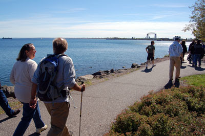
Mike Link and Kate Crowley finished their hike around Lake Superior in dramatic fashion yesterday. Their online progress map, showing each little blip where they stopped and took readings, now fully loops the shore.


They came through Leif Erikson Park a little late, but like the Pied Piper, they had already attracted a crowd. A few dozen folks had been waiting at the park, and they flocked to join in.


So in a swirling group of 60-80 friends and fans and media, they finished the last stretch of the 1550-mile hike right down Duluth's popular Downtown Lakewalk. Kate walked with her grandkids for awhile, once stopping the whole home stretch parade to pick up her granddaughter's cap. Her priorities are still in the right place!


Mike was chatting up the media, and he took the time to tell the reporter on tape that I have "the best blog in the Great Lakes." Hey, Mike, right back at ya, you mature eagle you.

The end was sort of anticlimatic...they got back to the Lakewalk in front of the Canal Park Lodge, and there was no archway, no winner's tape, no painted finish line. Mike and Kate invited the crowd that had grown to over 100 back down to the cobblestone beach, and Mike announced, "Well, we just finished our hike of 1550 miles around Lake Superior." A few people clapped, then all the rest joined in. I guess that's what you might call a well-deserved round of applause.

From one fan, big thanks to Mike and Kate and all their support crew for an inspiring job well done. I'll leave the last word to (I think) Kate,from their last dispatch:

"This momentous adventure comes to an end today, but only in the physical sense. The lake is imprinted in our minds and hearts and we will be forever thankful for the opportunity to have spent 145 days by its side. We have done something grand and we know more adventures lay ahead."

Thursday, September 16, 2010

Four saltie ships, four celestial surfers


Out in big broad Lake Superior, salties have been at anchor waiting for the fall harvest to come in to Duluth's grain elevators. Meanwhile, local surfers have been waiting for the swells to come in to Duluth's surf breaks. The surfers got theirs first. This morning there were four ocean-going ships and four stand-up surfboarders out on the lake behind our house. Something about that symmetry of four and four really captured my imagination, so I grabbed the camera to take some pictures.


The stand-up surfers were paddling out into the waves, turning and riding the waves back in. Their wetsuit-clad figures looked symbolic and eerie, like pictographs on the water; they stood so straight and their boards were hidden under the water line. If I had been a ancient Anishinabe and seen these guys, I would be sure they were gods, gliding over the lake's surface.


Another lovely, ethereal morning on the shores of Lake Superior.

Monday, September 13, 2010

Hike the REAL North Shore


Hiking is never just about getting from Point A to Point B. Mike Link and Kate Crowley know that very well. In fact, they are just going from Point A (Duluth) back to Point A (Duluth), the long way around Lake Superior.

To get from the eastern edge of Cascade River State Park to the Cascade River itself, there's an easy way, a moderate way, and a difficult way.

Easy is to follow Highway 61, the straight line cutting across the map above. Walking on Highway 61 is stressful and dangerous, with big trucks and fast cars roaring by.

Moderate is to follow the state park ski trail, the winding dotted line between Highway 61 and the lake. You can watch for birds and look for wildflowers and enjoy the occasional overlook out onto big blue Lake Superior.


Difficult is to follow the actual Lake Superior shoreline, which is what Mike and Kate do as much as they can. This is the REAL North Shore hiking experience, complete with colorful lichen, crashing waves, and big views all the time.

Cascade River State Park has many miles of Lake Superior shoreline, about two miles of which are accessible by trails. This shoreline walk is well over a mile, all on accessible ledgerock. It is the longest shore walk in the North Shore state parks. The routefinding is really fun. You work around boulders and navigate clefts in the rock, with low cliffs of 2-3 feet now and again. Start at the mouth of the Cascade River or at the park picnic area and go east.

Who needs a trail when Lake Superior combines with billion-year-old rock to provide a rugged pathway like this?

Friday, September 10, 2010

Mike and Kate: The journey and the destination


Lau Tzu wrote, "The journey of a thousand miles begins with a single step." It also has a lot of steps along the way. I got to share a few of those steps yesterday along Mike and Kate's thousand-mile journey.

I joined Mike Link and Kate Crowley yesterday, about 1450 miles of the way into their 1600-mile Full Circle Superior expedition Lake Superior. We hiked a lovely stretch of the Cascade River State Park shoreline, then made some serious miles along old roads parallel to Highway 61.


It was a real treat tagging along and getting a sense of their five-month journey. Although they had a definite goal of ten miles for the day (from County Road 7 to downtown Lutsen), there was always time to stop and look at rock formations, to identify birds, and to visit with friends along the way. The destination and the journey were equally important.

Mike, as always, is a font of natural history information, some of it is really only for nature geeks like me (like comparing the bedrock types we were walking on between syenite and diabase). Kate's observations are a bit more practical, like picking out good spot to video tape and sometimes gently correcting Mike. Although their destination is clear, they are very obviously enjoying the journey.


One nice thing about walking is that every step is optional. You choose to take each step you take, in whatever direction you want, however fast or slow as you want to. Mike and Kate seem to be getting the most out of every single step.

Monday, September 6, 2010

Here come Mike and Kate


In a stunning display of veteran perseverance, Mike Link and Kate Crowley have made it 90% of the way around Lake Superior. They've followed the Lake Superior shoreline from Duluth, across Wisconsin, tracing Michigan's serpentine peninsula, and braving the dramatic Ontario shore.

Now they are back in Minnesota, and the only thing slowing them down is themselves. Cranking out fifteen mile days, they could be to Duluth in a week. But the big arrival in Duluth is scheduled for September 19th, and they're making the most of their time back in their home state.

I can think of a few other folks I know who have taken off around Lake Superior with big big dreams. They went out fast, abused a tendon or a joint, and had to postpone or give up their plans. While Mike and Kate are doing big days, they aren't so big that they've lost their ability to move...or their will.

At last record, they had made it through the Grand Portage reservation and were camped at Judge Magney State Park. I'll be meeting them this week in the Schroeder/Little Marais area, to help them find a route along the lake shore and away from Highway 61.


Keep an eye out for the two hikers and their RV. It's the homestretch now, and the old coots are cranking along.